Field Activity Update, to March 25th, 2023
Project field work since the February 10 Update has included drilling using the modified underground drill rig, surface geology mapping and a campaign of digging with hand tools to locate historical drill hole collars.
Drilling: At the last BLOG report we had just collared hole N046, which ultimately completed following drilling to 796.45m. We then moved northward and collared hole N047 at the site from which holes GT001 and N038 were drilled, and collared a nominally horizontal hole on section with N038 and N036. Hole N047 is presently at 526m, continuing.
Since our last BLOG, when we indicated that no samples had been shipped to the laboratory, we have shipped 348 samples (including standards and blanks) from drill hole N045, and 429 samples (including standards and blanks) from drill hole N046: in each instance the samples were submitted in a single batch comprising all of the samples for each drill hole.
For reference the location of N045 and N046 were reviewed in the BLOG of February 20, and can be viewed in the interactive video (with user slider control) at interactive 3D or by clicking on the location map below.
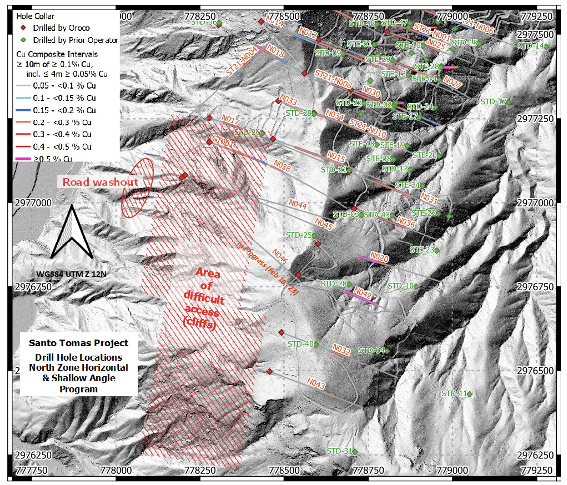
Map of southern the North Zone, Santo Tomas - illustrating the locations of the horizontal/shallow angle drill program (holes N044 - N046, with N047 now collared with N038 ).
Surface geological mapping: Mapping has been focused along the western flank of the area between the North and South Zones and on the SW extent of the South Zone where drilling has as yet not been conducted. The mapping has been focused on recognizing and measuring structural (fault) features and has located areas of outcropping mineralization, as shown in the picture-map following.
A short video-log of the area can be viewed via the hyperlink, by clicking on the map or image below or by clicking on our Twitter feed here.
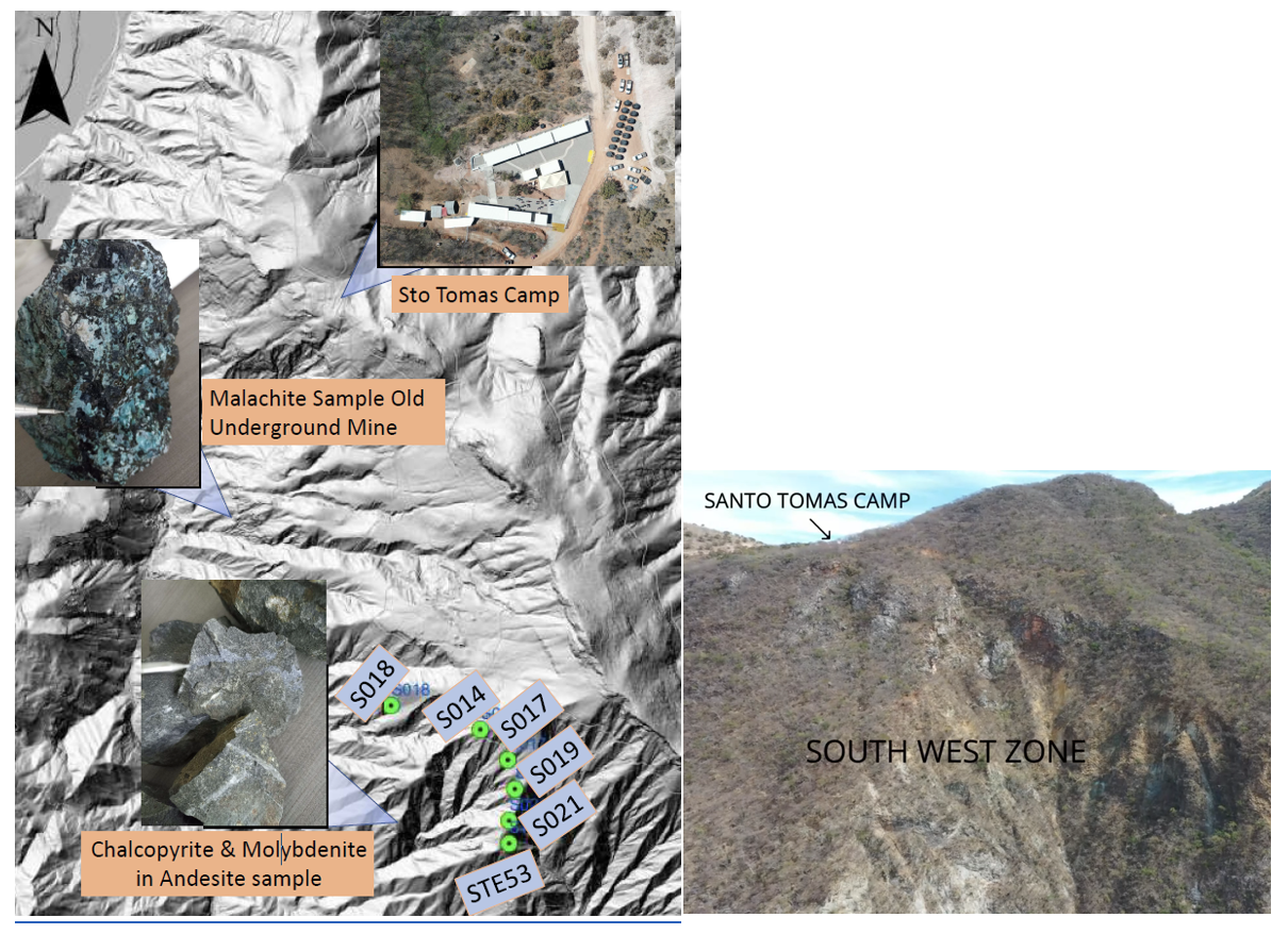
Map (left) showing South Camp and interesting mineral sample locations encountered during the current mapping campaign. Click on the Map (above) or Image (right, showing the Camp location and oxide mineralzation in the cliffs) to view a cameo of the mapping program.
Historical collar location: A number of historical collar locations at Santo Tomas have been estimated from the re-projection of historical survey grids onto the now standard ‘WGS’ global datum using the best information available to the project team. However, we have long known that some of the locations are inaccurate, as they have been offset from the known roads and obvious historical drill pads. As drilling support and other priority activities have wound down for the site surveyors and our support personnel, we have started a program of hand excavating areas to locate evidence of earlier drilling – in particular for the STD drill program. We started with trying to locate certain South Zone drill holes, where we have now found the cement-filled collars for seven (7) holes, and convincing labeling (engraved metal tags and small cement monuments) adjacent to most of these. As a result, we have improved our confidence in the location of holes STD-34 to 39 and STD-50, and the program will continue.
The discovery of the location of STD-50 was particularly instructive. Christiaan, one of our long-service field support crew, on describing the search for hole STD-50 to his grandfather (who had assisted prior operators in 1994), heard the suggestion that we look at a ‘remediated’ road spur adjacent to the start of steep ground on the southern end of the South Zone east road. When the crew went looking, they indeed found the remediated zone (heretofore unrecognized by us), and on some digging found the elusive collar location. In hindsight the spur is visible in the LiDAR image (see the map following), so we’ve learned both to poll the community seniors and to pay keener attention to the LiDAR in support of the program!
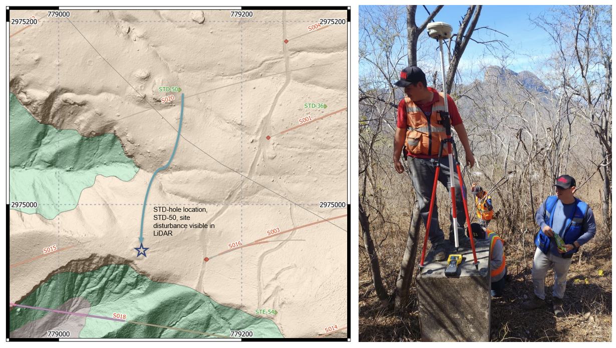
Map (left) showing the location of historical hole STD-50, overlaid on geology and LiDAR topography. The remediated zone is clearly visible now we know it is there! Christiaan (on a concession monument) with Alejandro, our site surveyor, undertaking field work early last year. The iconic ‘El Sapo’ (the Frog) mountain top located due west of South Camp is visible in the background.